GIS (Geographical Information System), is a decision support system that collect, storage, update, analyze and display spatial and geographical location-based data for a specific aim from Earth’s surface.
GIS (Geographic Information System) - What is GIS?
The History of GIS
The concept of GIS field and GIS practices were first started by Charles Picquet who mapped the cholera epidemic in 48 districts of Paris, followed by an English Doctor John Snow specially mapped the increasing deaths due to cholera epidemic. John Snow’s maps were based on detecting the source of the epidemic according to location and avoiding to spread the disease.
GIS was first introduced in 1960s by IBM team under the guidance of Roger Tomlinson. The concept of GIS was suggested to collate, store and analyze land usage data in Canada. He was selected by Canadian government to create and manage administrable natural source of Canada. His plan was to combine all-natural source data of Canada using computer. Thus, he created an automatic computing system to store, manage large amounts of data and to start Canada’s national land use management program. He named this system as Geographical Information System. The result of this process was the first computer-based GIS.
This process was followed by commercial desktop software released since the early 80’s. Today, there is a big development of GIS, GIS Technology and web-based platform according to development of computer technology.
Components of GIS
GIS can be used as a tool in both problem solving and decision-making processes, as well as for visualization of data in a spatial environment. Geospatial data can be analyzed to determine (1) the location of features and relations to other features, (2) where the most and/or least of some feature exists, (3) the density of features in a given space, (4) what is happening inside an area of interest (AOI), (5) what is happening nearby some feature or phenomenon, and (6) and how a specific area has changed over time (and in what way).
Hardware
Software
Data
People
Methods
GIS software provides the functions and tools needed to store, analyze, and display geographic information. Key software components are:
- • Tools for the input and manipulation of geographic information
- • A database management system (DBMS)
- • Tools that support geographic query, analysis, and visualization
- • A graphical user interface (GUI) for easy access to tools
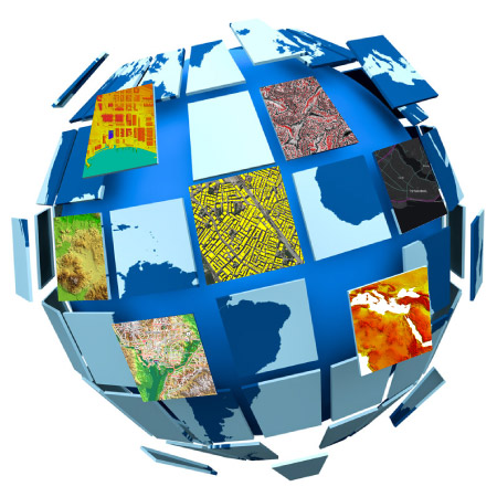
What are the GIS Data Types?
There are 3 types of data types in GIS. These are vector data, raster data and non-geographic attribute data.
Vector data model, stores objects consisting of point, lines and areas with x and y values according to a specific coordinate system. It is easy to locate spatial objects by finding coordinate information.
Raster data model, is formed by dividing images into small pieces and grouping adjacent cells together. Each cell is called a pixel. Cell size determines resolution. The smaller the cell size, the higher the map resolution.
Non-geographic attribute data, is information that presents the properties of any object that does not have a map.
Generating a GIS Database
Database is the environment where data is stored and safekept. The GIS data models to be used while generating the database in GIS should be stored in a proper structure, in a certain order. These data models should be efficient, quickly accessible and easily manageable. Database is an important component of Geographical Information Systems and gains value when it used effectively.
Database Management System
Database management system is a system that enables users to access, manage, report and view the database in corporate applications.
What does GIS do?
Geographical Information Systems enable analysis that cannot be done otherwise by adding a geographical feature to data.
What is a Geographical Query?
Geographical query includes queries made between graphical (location-based) data and verbal (attribute) data. Verbal information can be displayed by searching through graphic data and selecting point, line and area objects on the map. For example, address or parcel information can be displayed spatially by querying attribute information with operation such as address and parcel inquires. Queries can be done on a single layer or more detailed by associating more than one layer with each other.
Queries that include, do not include, intersect, do not intersect, touch each other, remain in a certain buffer area can be given as examples.

What Do “GIS Maps” Mean?
GIS digital maps can be easily shaped for the purpose or analysis needed according to geographic or non-geographic data.
Different types of maps can be produced with various data layers in GIS. GIS maps are especially used for visualizing and displaying the analyzes and studies on the screen or printing. With smart mapping, updating the data on the map, adding and removing new data can be done easier.
- GIS maps are used to compare the effects of human activity on nature.
- GIS maps are used to predict settlements that will be damaged in natural disasters or to identify and visualize risky areas.
- Information such as the average income of a particular region, book sales or voting numbers can be associated. Even presentations and analyzes can be made by creating thematic maps based on this data.
- GIS maps can be used to show information about numbers and density. For instance, it can show how many doctors are in a particular region compared to the population.
- Changes of many events over time can be revealed with GIS technology. Comparative maps can be created to examine issues such as advancement or retraction of ice cover in polar regions and how this event has changed over time.
- Spatial information of the area of study can be displayed with GIS maps.
- GIS maps are used in determining the value, boundaries, ownership and characteristics of the cadastral land in a certain region, keeping and managing the legal status records.
What are the Advantages of GIS? - What Does It Do?
GIS is a tool used in situations related to space, explaining the spatial relationships of events, making decisions and achieving results
Geographical Information Systems enable better decision making, keeping geographical records, managing geographic data and reducing the cost of working with high efficiency.
Usage Areas of Geographical Information Systems
With the development of computer technology, Geographic Information systems are used for tracking, planning and analysis in many professions and fields of business.
All data recorded digitally are associated with each other and their geographical location, and spatial analysis can be made with these data. Geographical Information Systems play an important role in analysis of spatial data, mapping, infrastructure / superstructure systems and solutions in order to develop more effective planning and management practices, to make fast and appropriate decisions, to reduce costs and to provide better services.
GIS is used in all projects in the public and private sectors that contain addresses, coordinates, parcels or inventories.
Where is GIS used?
Some of the examples within the application areas of GIS are as follows:
- • Cartography
- • Telecom Network Management
- • Electricity Distribution Network Management
- • Natural Gas Distribution Network Management
- • Water and Sewerage Distribution Network Management
- • Traffic Management
- • Urban Planning Management
- • Transportation Planning
- • Environmental Impact Analysis
- • Agricultural and Forestry Practices
- • Disaster Management and Prevention of Disasters
- • Natural Resources Management
- • Banking and Insurance Sector
- • Cargo Sector
- • Land Measurement and Evaluation
- • Earth Sciences
- • Asset Management and Maintenance
- • Planning and Social Development
- • Municipality
- • Health
- • Education
- • Mining
- • Industry
- • Economy
What is a GIS Specialist?
Geographic Information Systems Specialists are people who can perform analysis and reporting processes required in projects using GIS programs.
What does a GIS Specialists do?
GIS expertise provides;
- Obtaining / producing the required data by using appropriate hardware, network infrastructure, software according to the GIS project,
- Preparation, questioning analyzing, mapping, archiving, reporting, interpreting of metadata within the framework of geographic business intelligence using the appropriate GIS, CAD (Computer Aided Design), remote sensing and database software.
GIS Applications
Geographical Information Systems are not limited to the creation of maps, but offers many more capabilities to its users with various software developed specifically for the application area. Due to its advantages, GIS are expanding rapidly by finding new applications day by day and are used for different purposes.
Various GIS applications are created through related software depending on the needs and demands of public and private sector organizations. GIS software companies working in this field have become able to develop GIS applications on mobile devices as well as desktop and web applications, due to the rapid advances in the world of technology. In particular, the increase in the use of mobile devices and their easy portability and accessibility allow the applications developed in this environment to increase and spread day by day. The main criteria for GIS applications are the suitability of the applications for the intended use, healthy analysis and easy / flexible use.
GIS Application Examples
As a company specialized on GIS, Mapbis Inc. offers a variety of solutions, applications for corporations.
Some of the GIS application examples of Mapbis Inc. are given below.
Smart Infrastructure Management

PowernetMaestro Electricity Suite is an application which enables electricity distribution networks to be managed in a rule-based way. Data entry is based on predefined rules. Diverse types of data (physical network, customer addresses and billing, SCADA monitors) are combined seamlessly and displayed as layers on a map that the user can customize. Data are subject to approval before inclusion in the database, and are continuously updated. Thematic maps, analyses and reports are easy to generate. PowernetMaestro enables the user to find and make the best returns on investment.

GasnetMaestro Natural Gas Suite is an application which enables natural gas distribution networks to be managed in a rule-based way. Data entry is based on predefined rules. In case of emergency, users can easily see which valves to close. Managers can see the big picture of their network’s inventory in terms of pipe characteristics and fittings. The customer relations department can see which buildings are served, and which will be served next year.

TelconetMaestro Telecom Suite enables telecom companies to pursue new strategies by unifying all operations geographically. Mapbis provides its own ready-to-use and customized software, and on-site support staff for startup and ongoing development.
Our clients become able to extract the maximum information from any previously used data formats, e.g., paper maps, while integrating them into a digitally zoomable, searchable environment. Decisions on new fiber optic lines in the network can be made strategically. Customer data can be updated in real time and analyzed at any scale, and are integrated with all other available knowledge for instant use in daily operations and strategic growth.
TelconetMaestro is implementing telecom specific GIS solutions for fixed-line and cable TV networks for many different companies.

HydronetMaestro Water Suite is a ready-to-use software environment that simplifies the management of water and wastewater infrastructure. HydronetMaestro is GIS-based, so all data are digitally integrated for easier monitoring: subscriber information, network status, and network inventory. For each subscriber in the customer information system, a location in the real world is known. This knowledge effectively guides procedures such as meter installation/removal and network maintenance, and defines exactly which subscribers are affected. Also, water consumption and projected need can be calculated and reported by location.

PwrMetrix is a software that helps you focus on which types of power outages cause more cost or revenue loss, find the costliest locations, and provide information to hundreds of thousands of subscribers.
Field Workforce Management and Navigation

TEAMER, developed as a field workforce management software and optimization product, is a GIS-based system, designed for companies / institutions that have teams in the field to manage, optimize, visualize and report projects and works carried out in the field.
With the TEAMER application, you can determine the service points and the planning rules of the service you provide to your customers, create daily / weekly visit plans according to the characteristics of your team, you can easily communicate and manage with your field team from a single application based on location, and ensure that your field personnel reach the scene in the fastest and shortest way.
TEAMER is a cloud-based service provider consisting of a web-based administrative staff application and a mobile application developed for field teams. Jobs created through the web application are assigned to the relevant teams and the teams can update the details of the assigned job by conducting field studies via the mobile application.