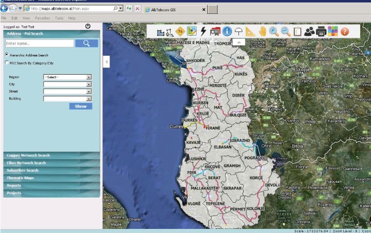
How a rapidly growing telecom managers are now able to see customer patterns, monitor physical networks, calculate profits and plan fiber optic upgrades – all on a single clickable landscape
Client: ALBtelecom: ~ 1 million total subscribers, 1400 employees, 6000 km of cable
Challenge: Fragmented data from paper maps, customer records and inventory
Solution:Mapbis developed a scalable GIS environment, synthesizing all data into an instantly updatable system providing easy monitoring, analyses and planning

Currently available internet speed by service region (left) and individual building (right), displayed in the Mapbis data environment developed for ALBtelecom
Client background and challenge
ALBtelecom, formerly a government agency and telecommunications provider in Albania, was privatized in 2007 and since then has been growing rapidly. The managers of ALBtelecom wanted to use their customer and network data more strategically. The problem was that the data were stored unsustainably in many different formats, including paper maps, CAD files, and scanned images.
Solution
Mapbis integrated the diverse data into a single, easy-to-use geographic information system (GIS). This way, ALBtelecom became able to analyze customer patterns, calculate revenues and costs, and plan the best way to install new fiber optic lines – all geographically, and zoomable to any scale, from a single home address to the entire country and beyond. More importantly, ALBtelecom staff are now able to synthesize all available knowledge as they decide where their company will go next.
What exactly did Mapbis provide?
- Data synthesis in an easily usable, password accessible, unified system for managers, engineers, operators, sales staff and field crews
- Desktop application modules that simplify comprehensive data entry and analysis
- Web-based applications for marketing and sales management and spatial decision-making
- Each customer was located by correct address superimposed on the network map, enabling individual or category statistics to be generated at any scale
- Web-based applications for maintenance field crews, enabling network status updates in real time
- Network was digitized to show physical connectivity for better maintenance and planning
- With SAP integration, progress of investments (eg, new cable installations) now can be monitored by map
Where next?
ALBtelecom, using Mapbis integrated GIS environment, is now ready to improve field sales and maintenance through real-time network data accessed with mobile tablets. ALBtelecom is also ready to project returns on investments by location, capacity, and usage rates, as it makes the transition from a mostly copper to a fiber optic network. All applications developed for ALBtelecom can easily be scaled up for larger company operations (please see the Turk Telekom Group case study).
Before GIS and SAP integration we could not trust any data in the systems – it was all vague. Through GIS, all data became visible and reliable, and now it is easy to make better decisions
Vahap YeroAYlu
CEO
ALBtelecom
Client profile: ALBtelecom
- Former government agency in Albania
- Privatized in 2007
- Acquired Eagle Mobile in 2013
- Provider of landline (3800 km copper and 2200 km fiber optic) and GSM, DSL, dedicated internet access, FTTx, intranet, ISDN, prepaid cards, and other services
~ 260,000 landline subscribers
~ 50,000 field and distribution boxes
~ 29,000 km2 service area
- Currently upgrading to fiber optics
Technology used
- Oracle Spatial
- MapInfo, MapXtreme .Net
- SAP
- C#


